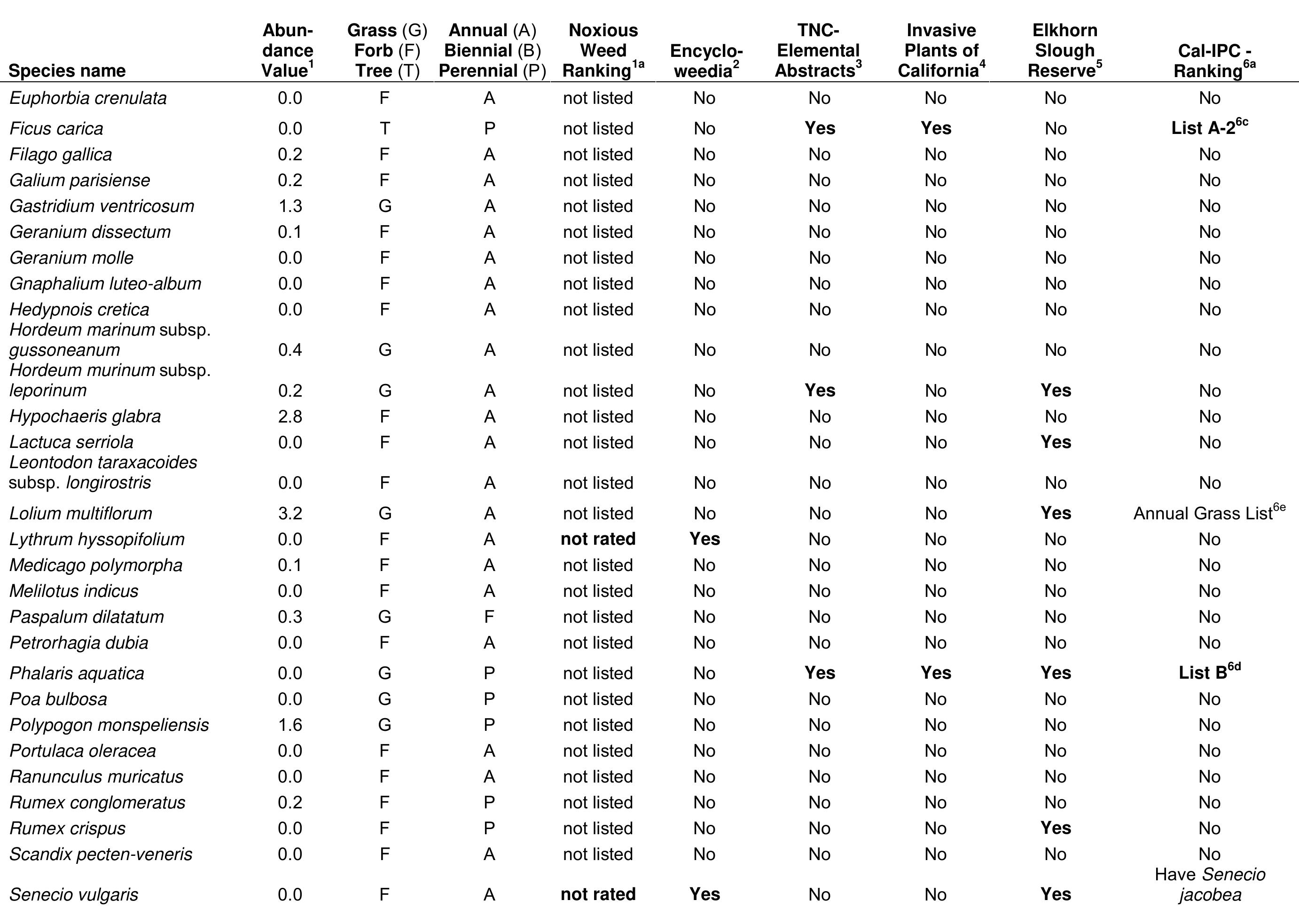
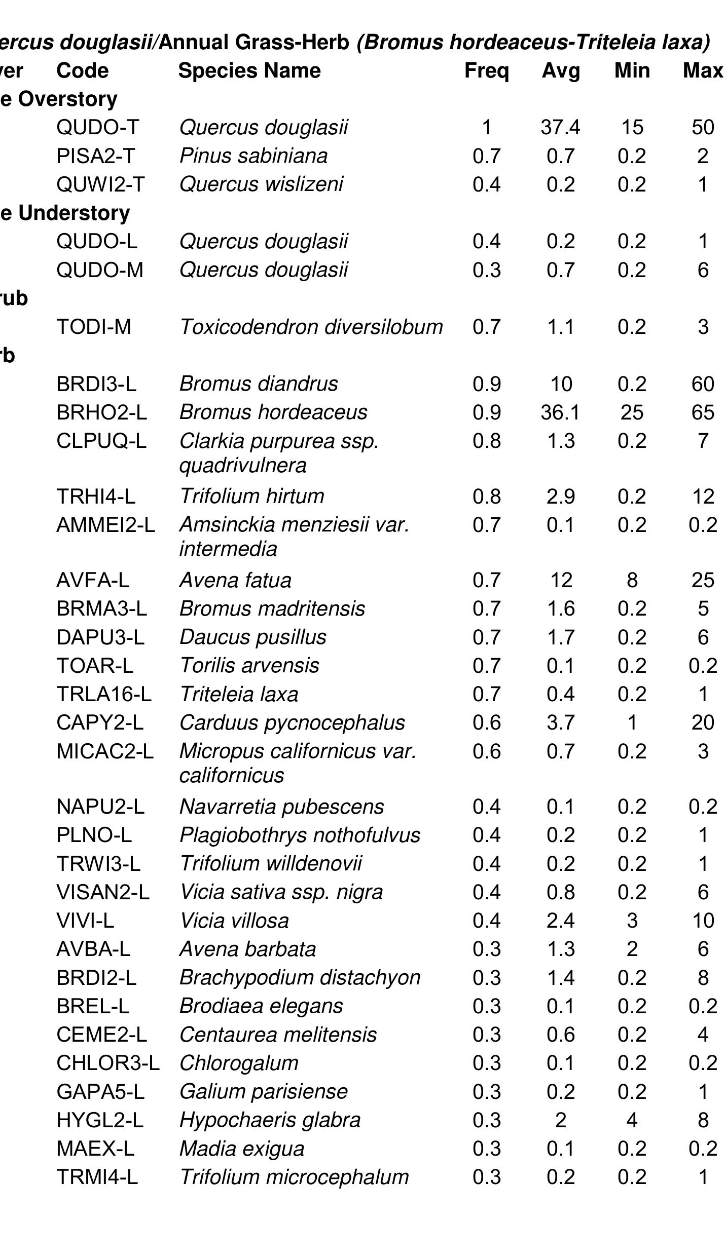
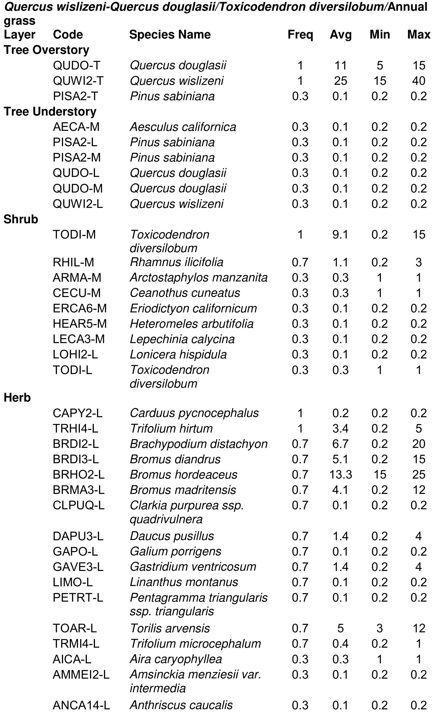
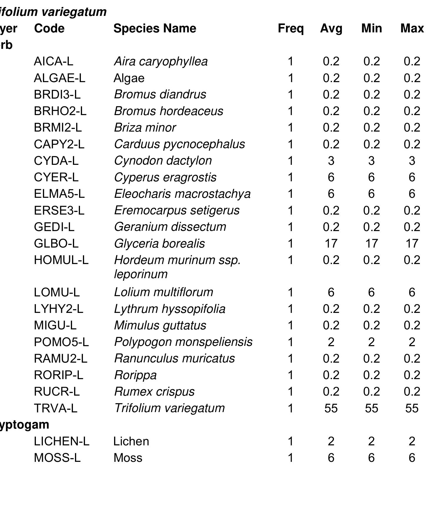
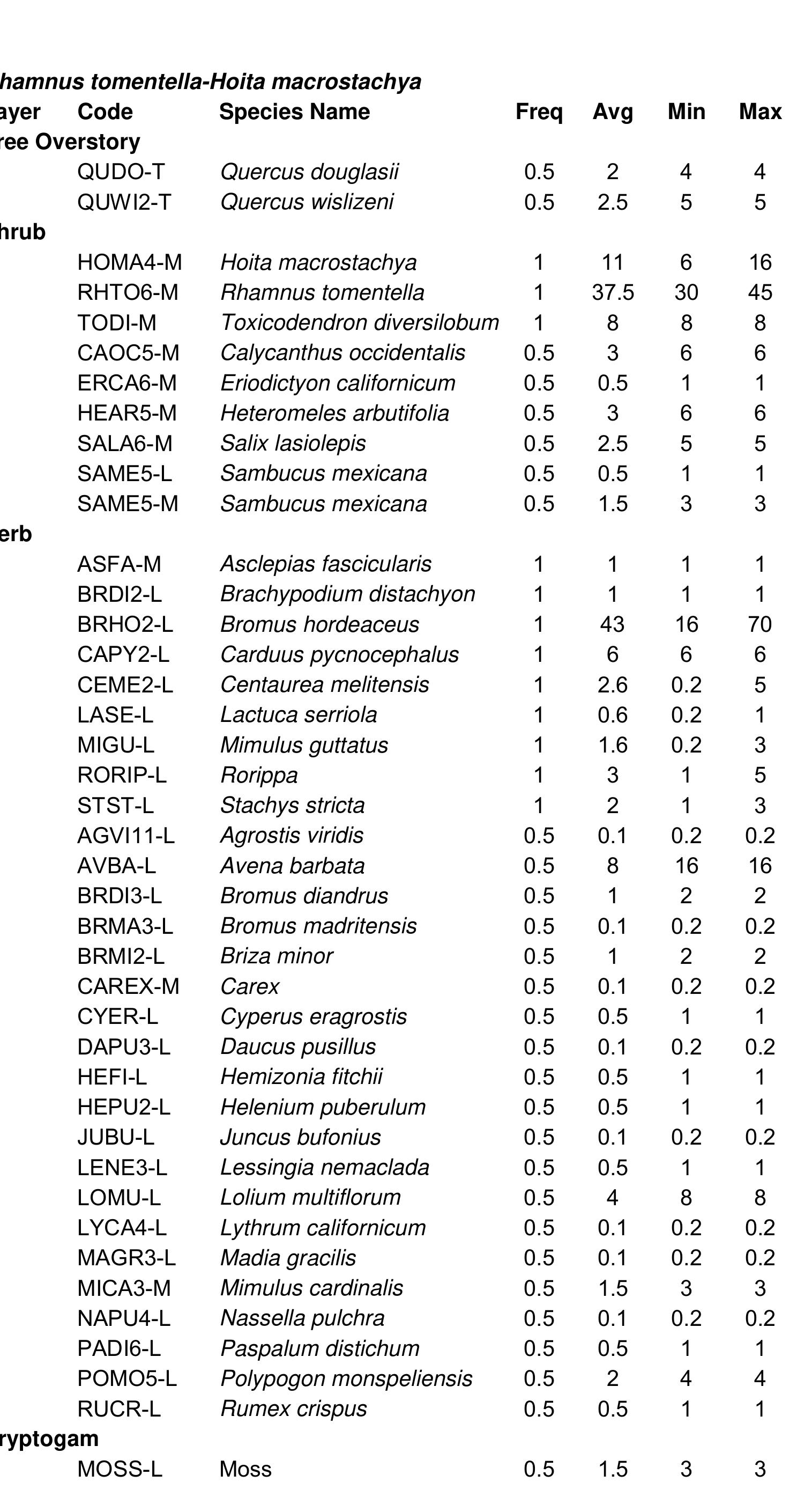
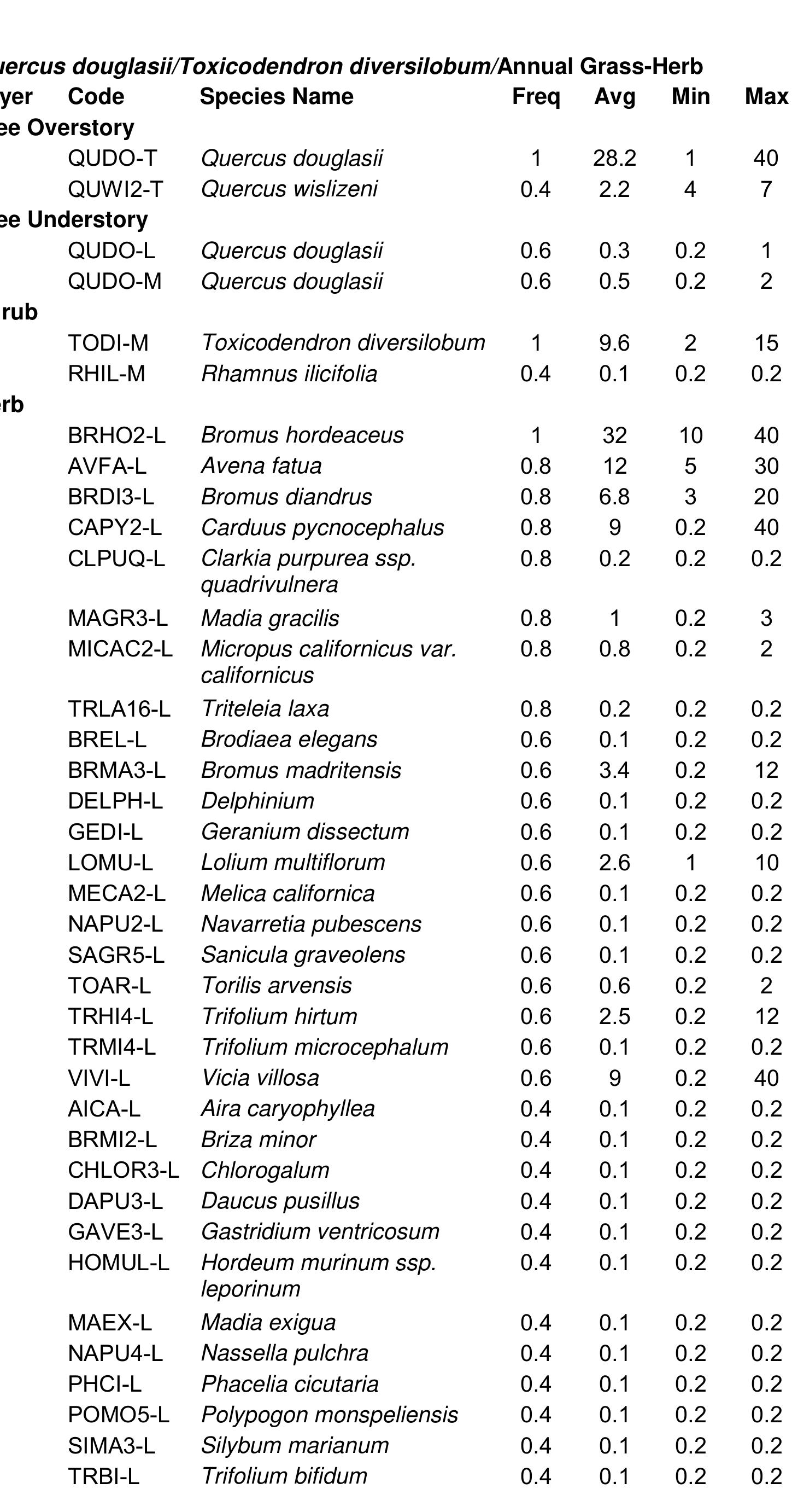
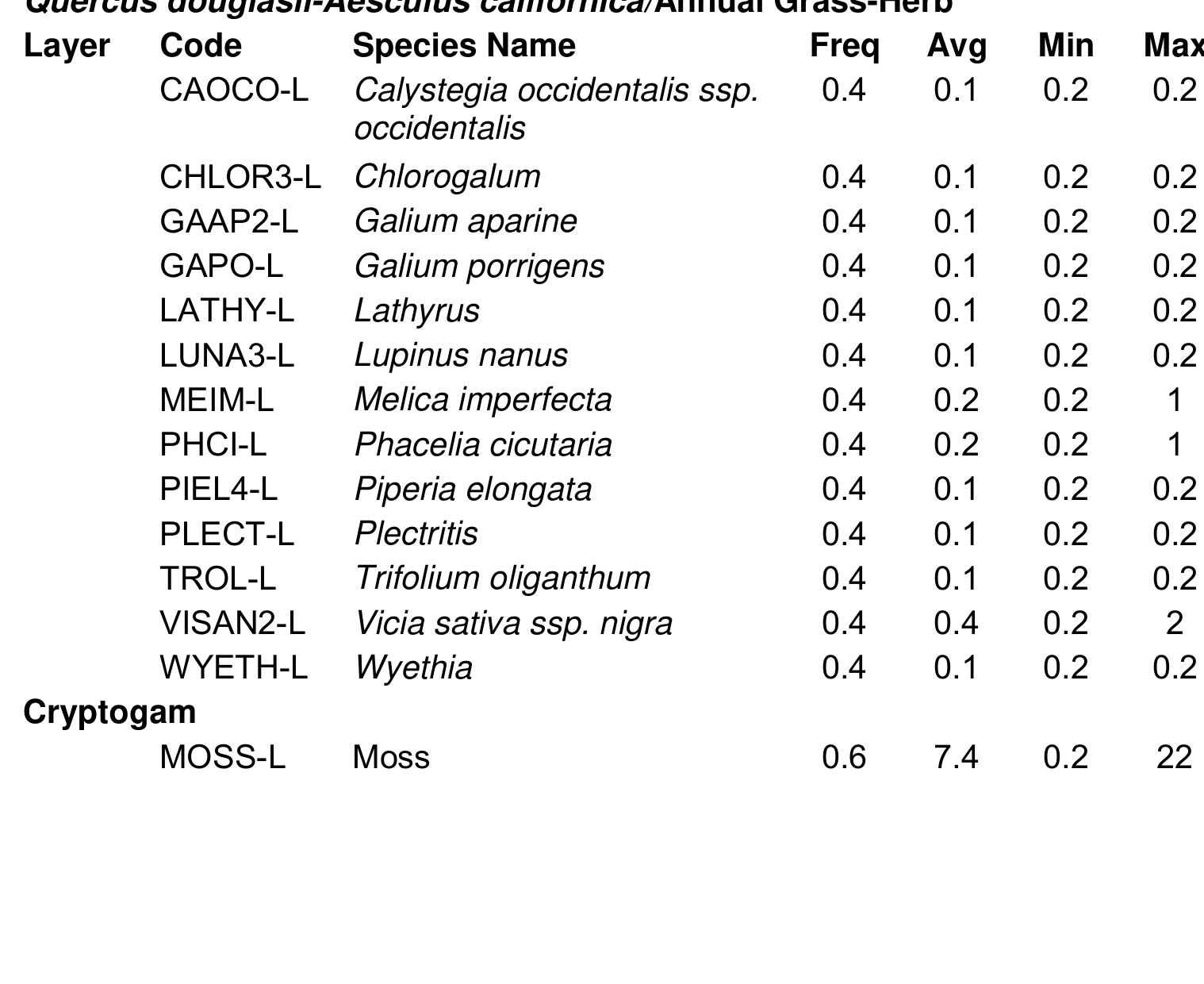
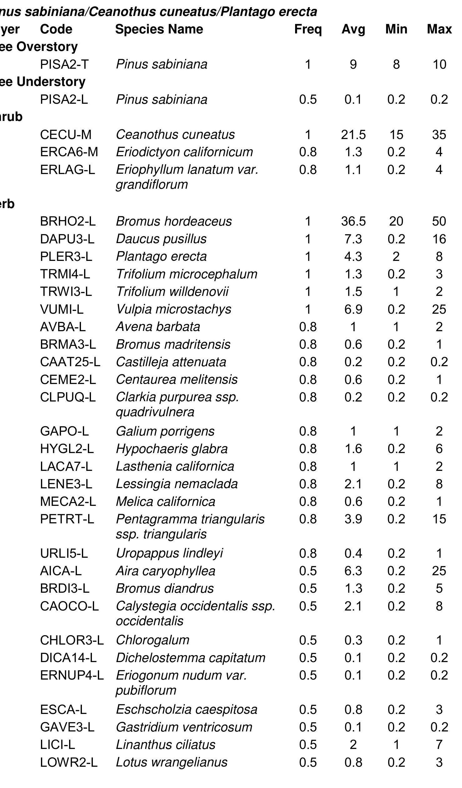
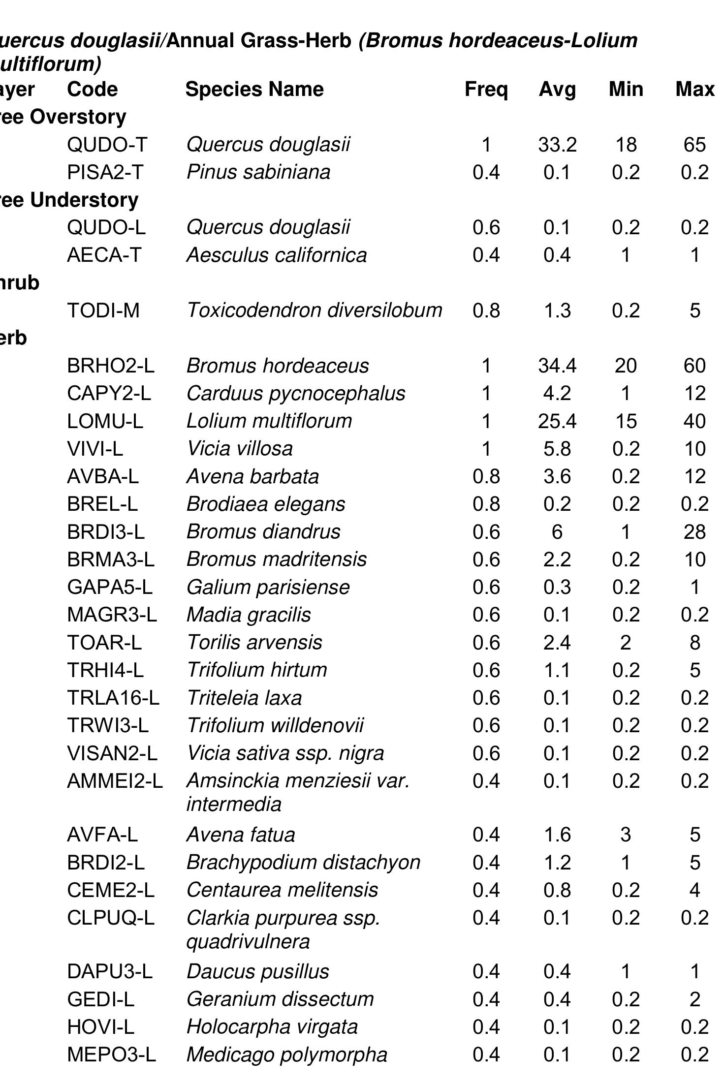
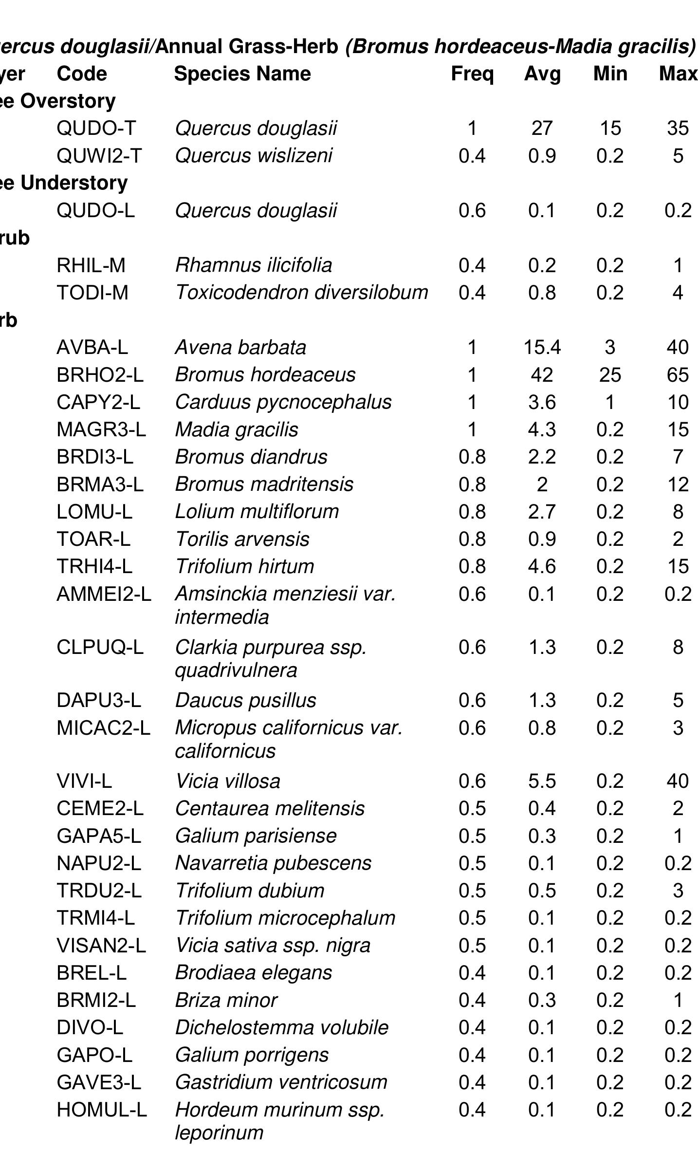
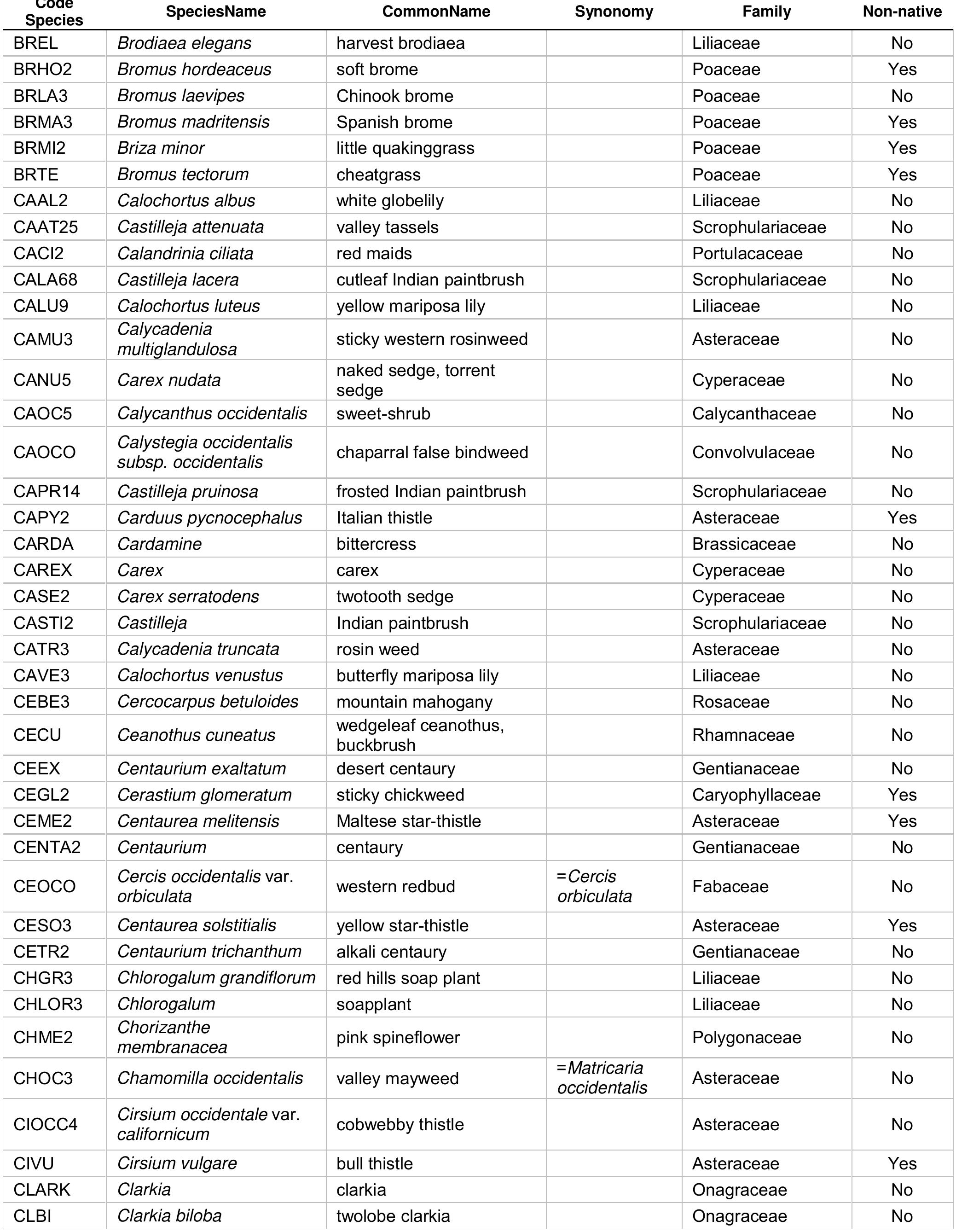
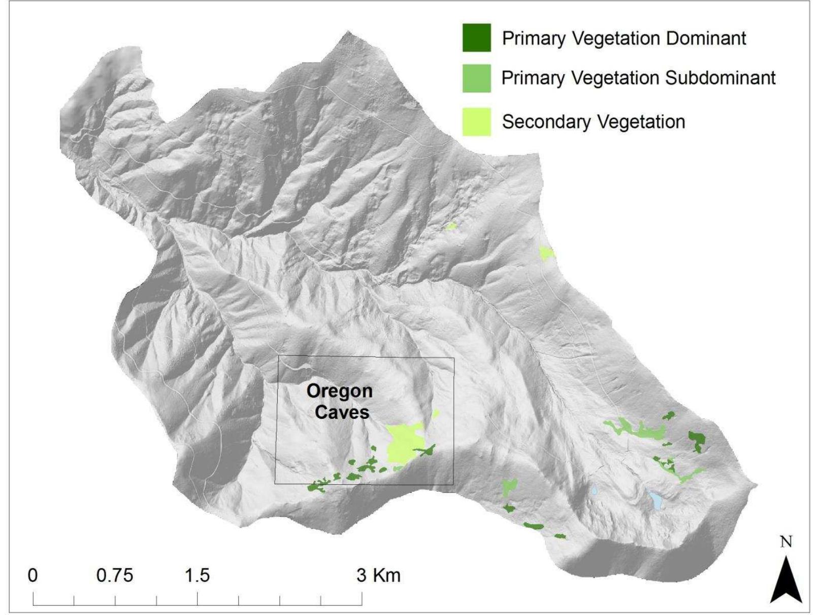
Numerous efforts are underway by public and private groups to assess the status of biodiversity in the state. Most are being conducted at local to subregional scales, and many are focused on species or communities of special concern....
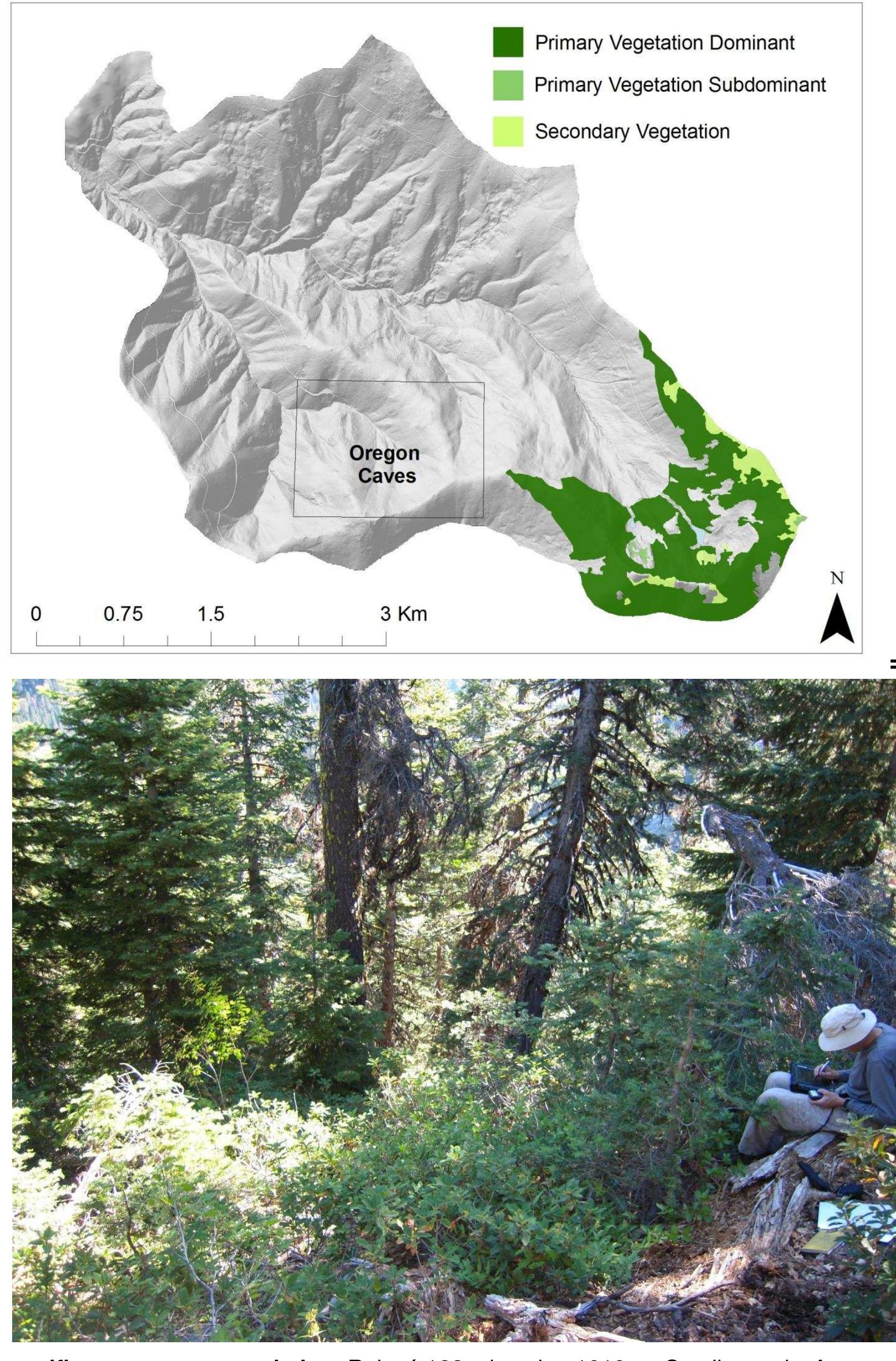
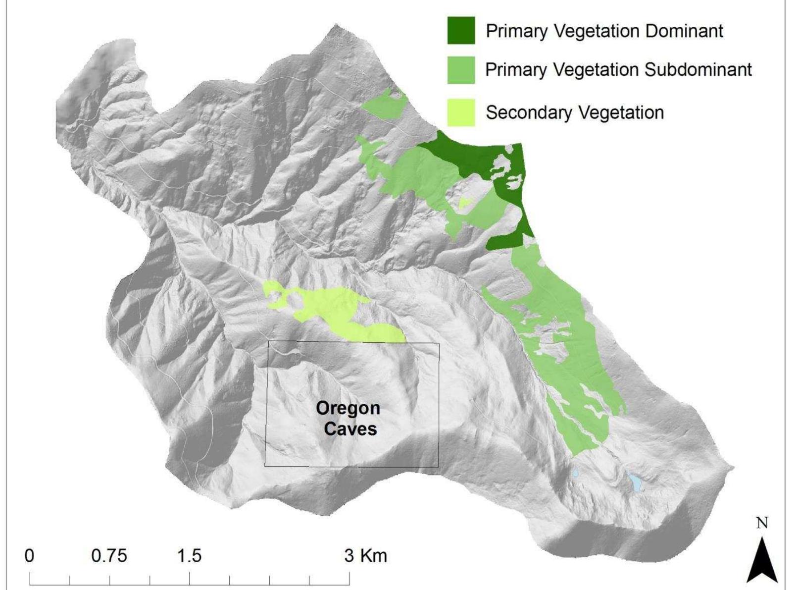
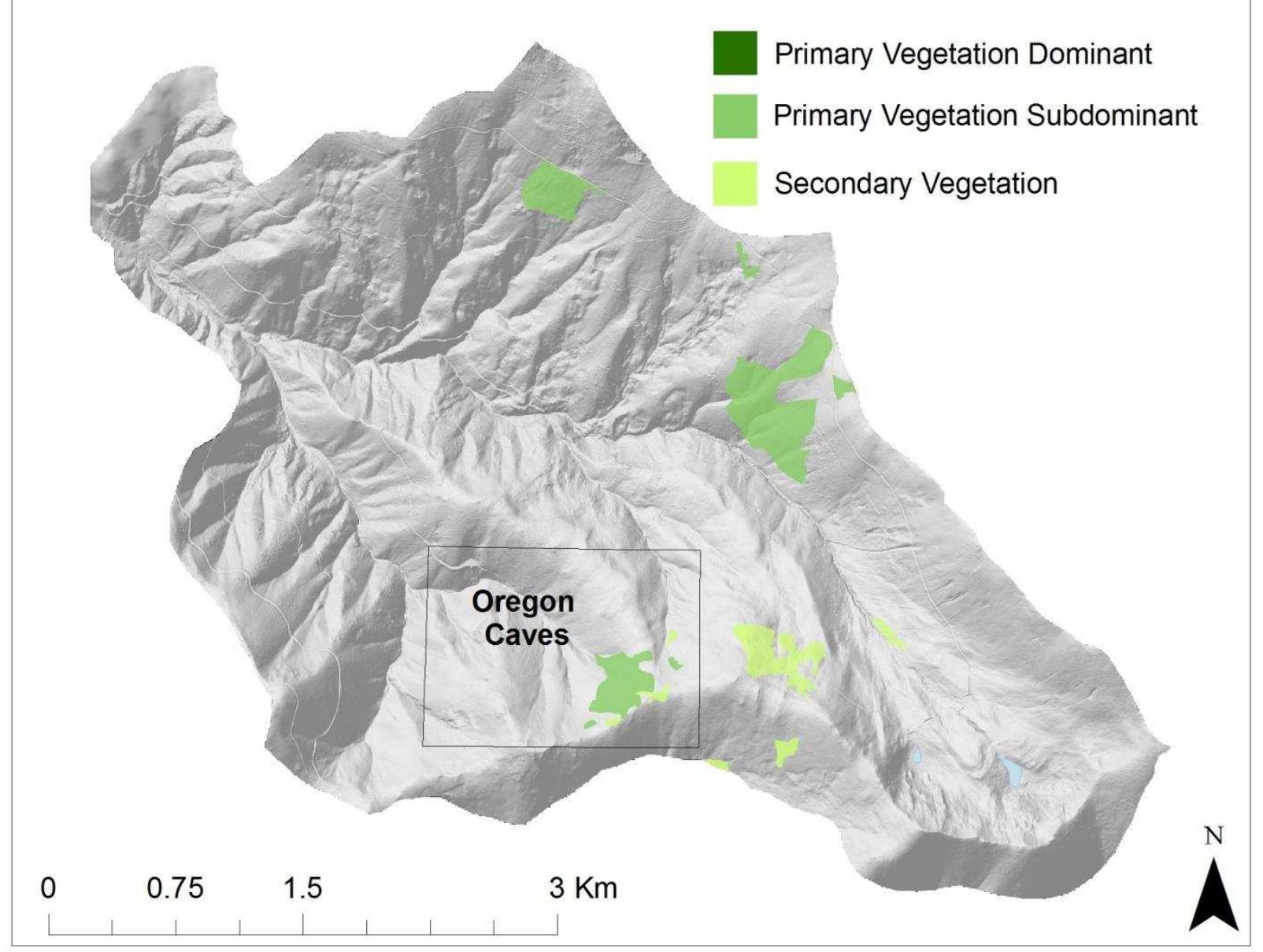
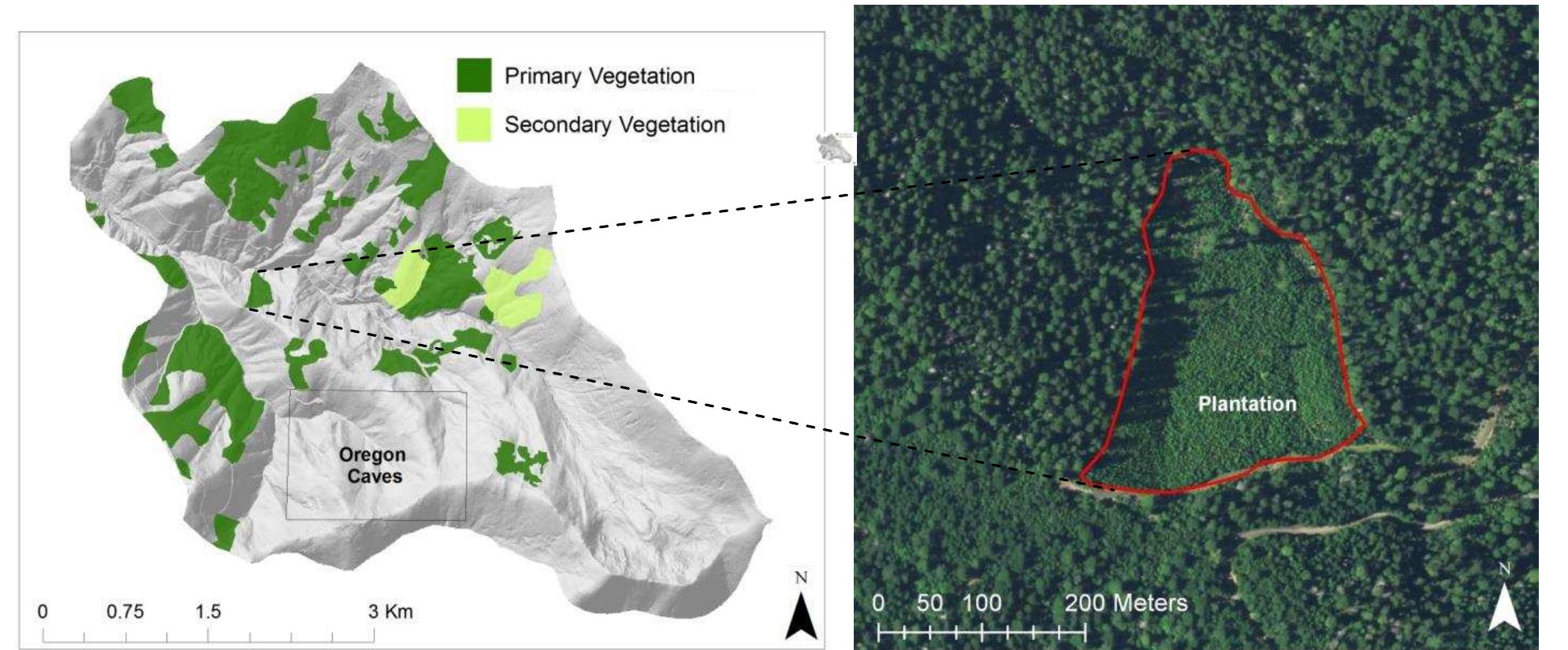
moreNumerous efforts are underway by public and private groups to assess the status of biodiversity in the state. Most are being conducted at local to subregional scales, and many are focused on species or communities of special concern. Currently lacking is an overview of the protection status of species and communities both statewide and in the western U.S. as a whole. This report describes a geographic information system (GIS) based Gap Analysis of biodiversity in the Southwestern California Ecoregion. The project is part of an ongoing effort by many groups, including the USFWS, the California Department of Fish and Game (CDF&G), Department of Forestry and Fire Protection (CDF&FP), The Nature Conservancy (TNC) and others to provide this regional overview by mapping the distributions of plant community types and vertebrate species habitats and relating these distributions to existing patterns of land ownership and land management. The work at UCSB is supported by the National Fish and Wildlife Foundation, the Southern California Edison Company (SCE), and the IBM Environmental Research Program and is part of a national program of state and regional gap analyses being coordinated by the USFWS. The term "Gap Analysis" refers to the evaluation of the protection status of plant communities, animal species and vertebrate species richness by GIS overlay of biological distribution data on a map of existing biological reserves. We are conducting a Gap Analysis of California in collaboration with a number of public and private groups. This entails preparing a statewide map of actual vegetation, supplemented with more detailed locality data for plant taxa of special concern. By compiling a statewide, albeit low resolution digital database, GIS capabilities can be used to identify and map landscapes in California that contain large numbers of potentially unprotected vegetation types and vertebrate species of interest. Such areas can then be studied in more detail as candidates for additional preservation and protection efforts to fill existing "gaps" in the protection network. This approach allows conservationists to be proactive rather than reactive in their efforts to preserve biodiversity. It should also result in fewer conflicts among developers and biologists. Because of the significant differences between parts of California in the ecology, land uses, and data availability, we have chosen to perforrn GIS-based analyses on ecologically-defined subareas of the state. The subdivision we have chosen is the region as defined for the forthcoming revision of the Jepson Manual of California's flora (Hickman, 1993). The Manual delineates ten regions in the state that roughly correspond to the bioregions proposed for state conservation planning. This report is limited to the Southwestern California Region, within the California Floristic Province. The gap analyses of the remaining nine regions will be reported separately as each is completed. Ultimately, a statewide gap analysis will be conducted with the data from the ten regions. The region includes 3,383,160 ha or roughly 8 percent of the area of California and is comprised of three subregions: South Coast, Transverse Ranges, and Peninsular Ranges. The region is bounded by the transition to the Sonoran and Mojave Desert regions on the east and the Santa Ynez Mountains on the north. Land Management: For the purposes of gap analysis, it is necessary to distinguish levels of management in order to determine the protection status of elements of biodiversity. Level 1 represents areas managed for the long-term protection of biodiversity, such as wilderness areas, research natural areas, National Wildlife Refuges, Areas of Critical Environmental Concern, state parks, ecological reserves, and private preserves and sanctuaries. Level 2 includes publicly-owned lands not specifically designated for Level 1 management, while Level 3 contains private lands with no formal management for biodiversity. A 1:100,000 scale management status map depicting these three levels and land ownership was compiled from many sources. Vegetation: A map of actual vegetation was produced using summer 1990 Landsat Thematic Mapper (TM) satellite imagery, 1990 high altitude color infrared photography (1:58,000 scale), Vegetation Type Mapping maps based on field surveys conducted between 1928 and 1940, and miscellaneous recent vegetation maps and ground surveys. Landscape boundaries were mapped subjectively by photointerpretation of patterns in the satellite imagery and air photos. Final delineation of a landscape unit was an iterative process based on lines of converging evidence obtained from the various source data. The map was produced using a minimum mapping unit of 100 ha (1 km 2 ), and the region was mapped into some 2,100 landscape units. 230 polygons (excluding urban and agricultural areas) were checked in the field, primarily by roadside reconnaissance. Based on our concept of landscape, we recorded a primary species complex, which was the most widespread vegetation type or land use/land cover type in the polygon, a secondary type, and the fraction of the landscape covered by each type. Each species complex was defined by up to three dominant species. Where possible, we also recorded the occurrence of minor overstory species of special conservation concern (e.g., Juglans californica, Quercus engeltnanii, Cupressus forbesii). Species composition was derived from field survey, air photos or from the VTM maps. VTM information was used for areas where air photos provided no evidence of recent disturbance, based on the assumption that canopy dominants observed by VTM field crews have not changed over the past 50-60 years. We also developed rules for assigning each species combination into Holland's classification of natural communities. We mapped 64 different communities (out of 89 recognized in the region). The premise of Gap Analysis is that biological resources at risk can be identified by their ownership/management profile as generated by GIS overlay of 1: 100,000 scale maps. Based on the profiles of communities already known to be at risk, we adopted the following criteria for identifying communities or dominant plant species at-risk: 1. Less than 10% of the distribution is in Level 1 areas, and the species or community type is endemic to the region, and the mapped distribution covers more than 100 km 2 or 2. over 70% of the mapped distribution is in Level 3 areas. Wildlife Distributions: Combining the California Wildlife Habitat Relationships (WHR) model with the vegetation map generated predicted distribution maps for native vertebrates. We used the WHR database to generate a set of presence/absence tables of species occurring within each of the major habitat types. Another component to the development of a set of predicted distribution maps is using a coarse-scale range map for general locality information. The maps used here are range outlines digitized from a state map at 1:3,500,000 scale and published as part of the VIM system ). The vegetation map was translated into the major habitat types used in the WHR system. The coarse-scale range map was then combined with the medium-scale vegetation map to produce a predicted distribution map for every species. By overlaying the predicted distribution maps with land management status, the proportion of a species' range in various levels of habitat protection was determined. The criteria for highest risk for breeding species whose habitats are rated either medium or high suitability or for migratory species with critical wintering habitat in the region are: 1. Less than 15% of the distribution is in Level I areas, and the species or a subspecies is endemic to the region, and the mapped distribution covers more than 100 km 2 and 2. The species does not find cropland, orchards/vineyards or urban habitats as either medium or high suitability, nor is it exclusively associated with wetlands. The species is not a marine mammal, shorebird, in the chiroptera order, introduced or intensively managed as either a harvest species or being translocated. Land Management: Level 1 areas total 324,773 ha or 9.6 percent of the region. Thirty percent is other public lands managed at Level 2, while the remaining 60 percent is Level 3. The area of level 1 managed areas is dominated by National Forest Wilderness Areas, with 226,185 hectares in 14 areas. State Parks, including Reserves and Wilderness Areas, are the second largest category of Level 1 areas, totaling 56,204 hectares. Lower elevations where most urban and agricultural development are located are predominately private land and therefore Level 3 management. Mid-elevations, between 1500 and 2500 meters are primarily public lands, with about 25 percent being Level 1 management, but most being Level 2. The majority of land above 2500 meters is in Level 1 management, and in fact more than 90 percent of the highest elevation zone is in Level I management (usually National Forest wilderness areas). Vegetation: Based on the GAP criteria, communities restricted largely to the lower elevations , such as nonnative grasslands and the coastal sage scrub types, are at considerable risk (Table ). Roughly 88% of areas below 500 rn are in Level 3 management (i.e. privately owned). A majority of the lands at these elevations have already been converted to agricultural or urban uses and most of the remaining lands are threatened with future urbanization. Especially alarming is the condition of the California black walnut woodlands. The southern variety of this species is endemic to this region and its current distribution is highly fragmented and reduced compared with its original distribution. Sagebrush steppe shrublands, although widespread elsewhere in California, appear vulnerable in this region. A significant proportion of the sagebrush steppe habitat is on Level 2 lands, and conservation concern for these communities can...